Google Maps has introduced a host of new features that will help people commuting in a time when restrictions and disruptions are commonplace, and providing them the necessary information in advance might be extremely useful. To start things, users will now see alerts from local transit agencies about restrictions, if any, on the route they are looking to take.
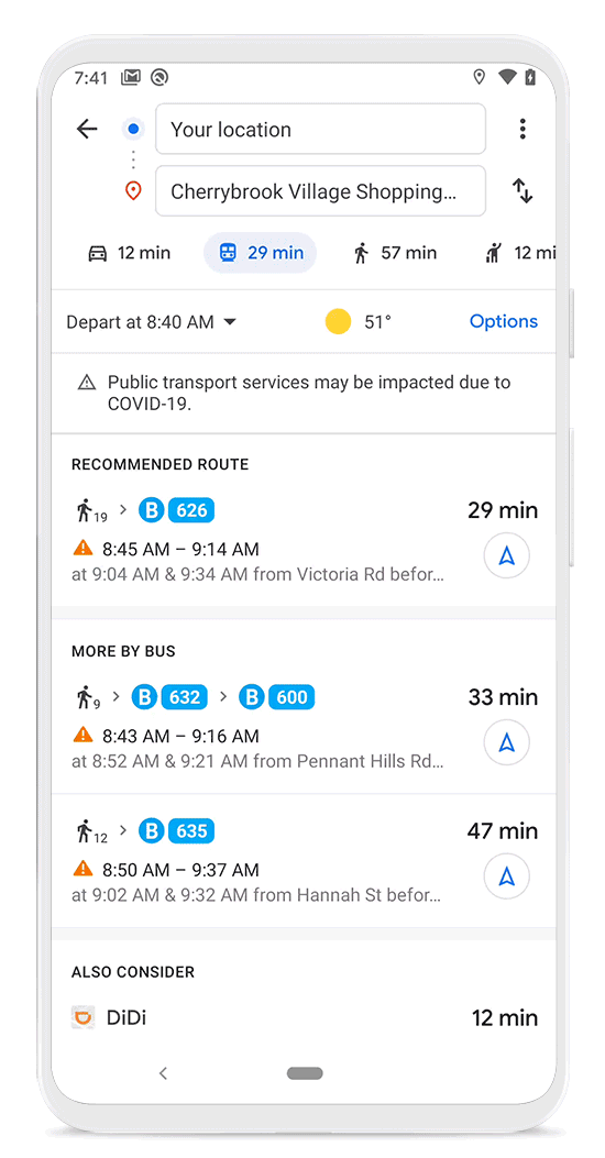
They will also see alerts on the directions screen while driving, informing them about checkpoints and other restrictions that they are expected to respect. Additionally, Google Maps will remind users to go through the eligibility rules and facility guidelines when they are navigating a coronavirus testing center or a medical facility.
Moreover, it is now easier for public transport users to check how crowded a boarding spot or station can be, based on data contributed by other Google Maps users. The crowdedness predictions will be available under the Transit Details section when users look up for Directions. Also, one can now check when a transit station is more or less crowded at a particular time.
Source: Google Blog
The post Google Maps adds new features to prepare you for life in the pandemic era appeared first on Pocketnow.